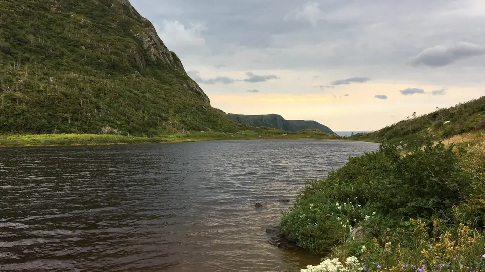
Hiking trails near Rocky Harbour
Six named trails in Gros Morne National Park, ranked by difficulty, with real distances, times and drive-from-town estimates.
Updated November 13, 2026
The two closest trails to Rocky Harbour — Berry Hill Pond and Baker's Brook Falls — both start at the same trailhead at Berry Hill Campground, about 5 km north of town on Route 430, and cover easy to moderate terrain. If you only have one full day and want the signature Gros Morne experience, that's Gros Morne Mountain; if you want an easy, iconic view with almost no effort, it's the boardwalk to the Western Brook Pond boat tour dock.
Distances, hiking times and ratings follow Parks Canada. Conditions can make the same trail take longer.
Trail reference at a glance
| Trail | Distance | Time | Rating |
|---|---|---|---|
| Berry Hill Pond | 2 km loop | 0.5–1 h | Easy |
| Western Brook Pond | 6 km return | 1–2 h walking | Easy |
| Baker's Brook Falls | 10 km return | 2–3 h | Moderate |
| Gros Morne Mountain | 17 km return | 6–8.5 h | Difficult |
| Lookout | 5.8 km loop | 2–3 h | Moderate |
| Tablelands | 4 km return | 1–2 h | Easy |
| Green Gardens | 9 km return | 3–4 h | Moderate |
Key takeaways
- Trail choice should be driven by fitness, weather and available daylight — not by which trail is most photographed.
- The two trails nearest Rocky Harbour (Berry Hill Pond, Baker's Brook Falls) share a trailhead about 15 minutes from town.
- Western Brook Pond, Lookout Trail and Green Gardens each require a separate drive of 25 minutes to over an hour.
- Gros Morne Mountain's summit route closes annually from May 1 through June 27 to protect wildlife during calving season.
- A national park entry pass is required for every one of these trails.
Easy trails
Berry Hill Pond Trail
A short, flat loop around Berry Hill Pond starting at Berry Hill Campground, 5 km north of Rocky Harbour on Route 430. The forested shoreline is a known beaver habitat, and it's a good walk before dinner or first thing in the morning, with nothing to plan. Ground can be muddy after rain.
Western Brook Pond Trail
This is the walk-in trail to the boat dock for the Western Brook Pond fjord tour, not a hike to a fjord viewpoint. There's no road to the pond. The trail is flat gravel and boardwalk through bog and forest. Most visitors combine the walk with the boat tour; see our Western Brook Pond guide for tour timing and booking notes.
Moderate trails
Baker's Brook Falls Trail
Starting from the same Berry Hill Campground trailhead as Berry Hill Pond, this trail crosses open bog on boardwalk before entering balsam fir forest along Baker's Brook, ending at a wide, stepped waterfall. It's longer than it feels, because the climb is gentle the whole way. Expect bugs in the forest sections in summer. Along the trail you pass fenced moose exclosures, plots that show what the forest looks like without moose browsing.
Lookout Trail
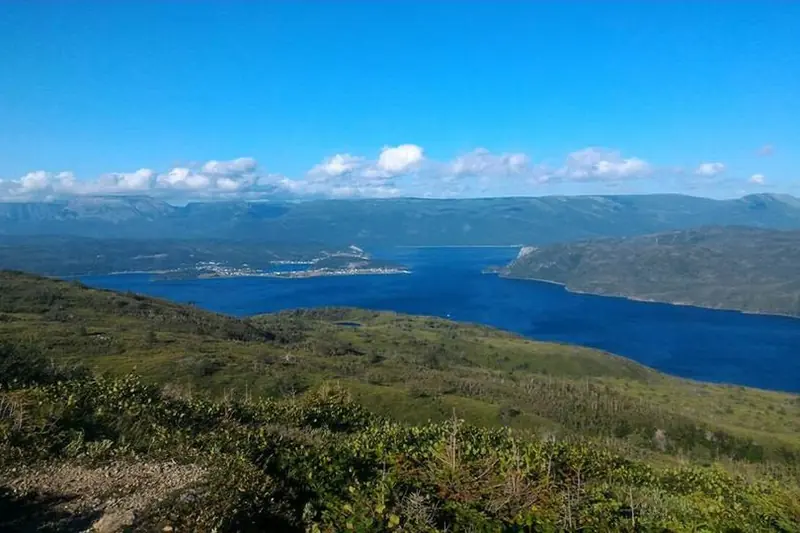
Starting behind the Discovery Centre near Woody Point on the south side of Bonne Bay, this trail climbs steadily through forest to a plateau on Partridgeberry Hill, with panoramic views of Bonne Bay, the Tablelands and Gros Morne Mountain. There's no direct road across Bonne Bay from Rocky Harbour, so budget the full drive time around the bay via Wiltondale.
Green Gardens Trail
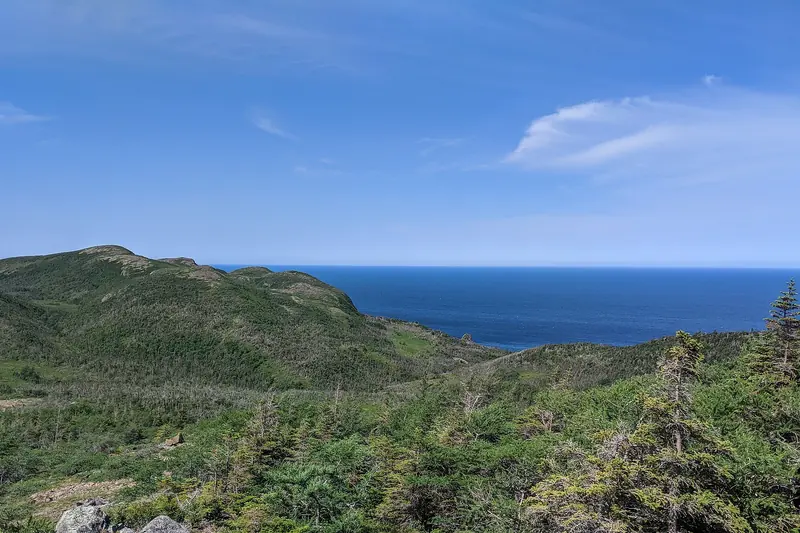
A coastal trail on the park's south side near Trout River, descending through heathland to sea stacks and a black-sand beach. It's a longer drive from Rocky Harbour than the other trails here, so pair it with a south-side day. See our Gros Morne south side guide.
Demanding trails
Gros Morne Mountain Trail (James Callaghan Trail)
This is the park's best-known hike and a big reason many people come to Rocky Harbour. It has two distinct parts: a 4.5-kilometre Approach Trail through forest to a viewing platform at the base, rated moderate on its own, followed by an 8-kilometre summit loop that climbs a steep, rocky gully onto an exposed arctic-alpine plateau at 806 metres, the second-highest point in Newfoundland. The summit route is closed every year from May 1 through June 27 to protect nesting and calving wildlife. Start early, carry about 3 litres of water per person for the full summit hike, and check current conditions at the Gros Morne Visitor Centre before you go. Staff can tell you about the weather, the footing and whether the summit route is open that day.
Practical advice
- Buy a park pass before you arrive at the trailhead. A national park entry pass is required for every one of these trails and is sold at the Gros Morne Visitor Centre and Discovery Centre.
- Cell service is limited on most trails. Tell someone your route and expected return time. The Gros Morne emergency contact number is 1-877-852-3100.
- Wear real hiking footwear. Trails mix wet rock, roots, boardwalk and loose gravel, even on the "easy" routes.
- Layer for weather that changes fast. Rain gear and warm layers matter even on trails rated easy, especially at exposed viewpoints.
- Plan driving time separately from hiking time. The park spans both sides of Bonne Bay; trails on the south side (Lookout, Green Gardens) can add well over an hour of driving each way from Rocky Harbour.
Common mistakes
Underestimating the drive between trailheads on opposite sides of Bonne Bay, starting Gros Morne Mountain too late in the day to finish before dark, assuming the summit route is open without checking the seasonal closure, relying on cell service for navigation, and wearing town footwear on boardwalk-and-root terrain that stays wet for days after rain.
FAQ
Do I need a permit to hike in Gros Morne National Park?
You need a valid national park entry pass to use any day-hiking trail in Gros Morne. No separate hiking permit is required for any of these trails. Backcountry camping requires a separate backcountry permit.
Is Gros Morne Mountain open right now?
The summit route closes every year from May 1 through June 27 to protect nesting and calving wildlife; the Approach Trail to the base usually stays open. Confirm current status with the Gros Morne Visitor Centre before you go.
Which hiking trail is closest to Rocky Harbour?
Berry Hill Pond and Baker's Brook Falls are the closest named trails, both starting from the Berry Hill Campground trailhead a short drive from town.
Can a beginner hike Gros Morne Mountain?
The 4.5-kilometre Approach Trail to the base is rated moderate and is achievable for a reasonably fit beginner. The full summit loop is a difficult, full-day route with a steep rocky gully and isn't a good first hike.
Trail distances, official ratings and standard hiking times are taken from Parks Canada. On the day, current conditions matter more than this table. Check the park trail page or ask at the visitor centre before you head out.